Ghostbusters
Bonanza Creek Ranch
The Tomorrow War
Top Gun - Maverick
Miscellaneous Movie locations
Fires
The Planet
Weather
Hurricane Tracker
News
Top 10 Tornados
Satellite Monitoring of Earth
News
Wildlife
General
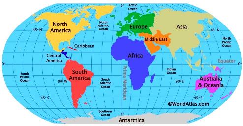
The Problem with 2D Maps
Borders
Geo-Politics
Economics
China
Cold War
British Isles
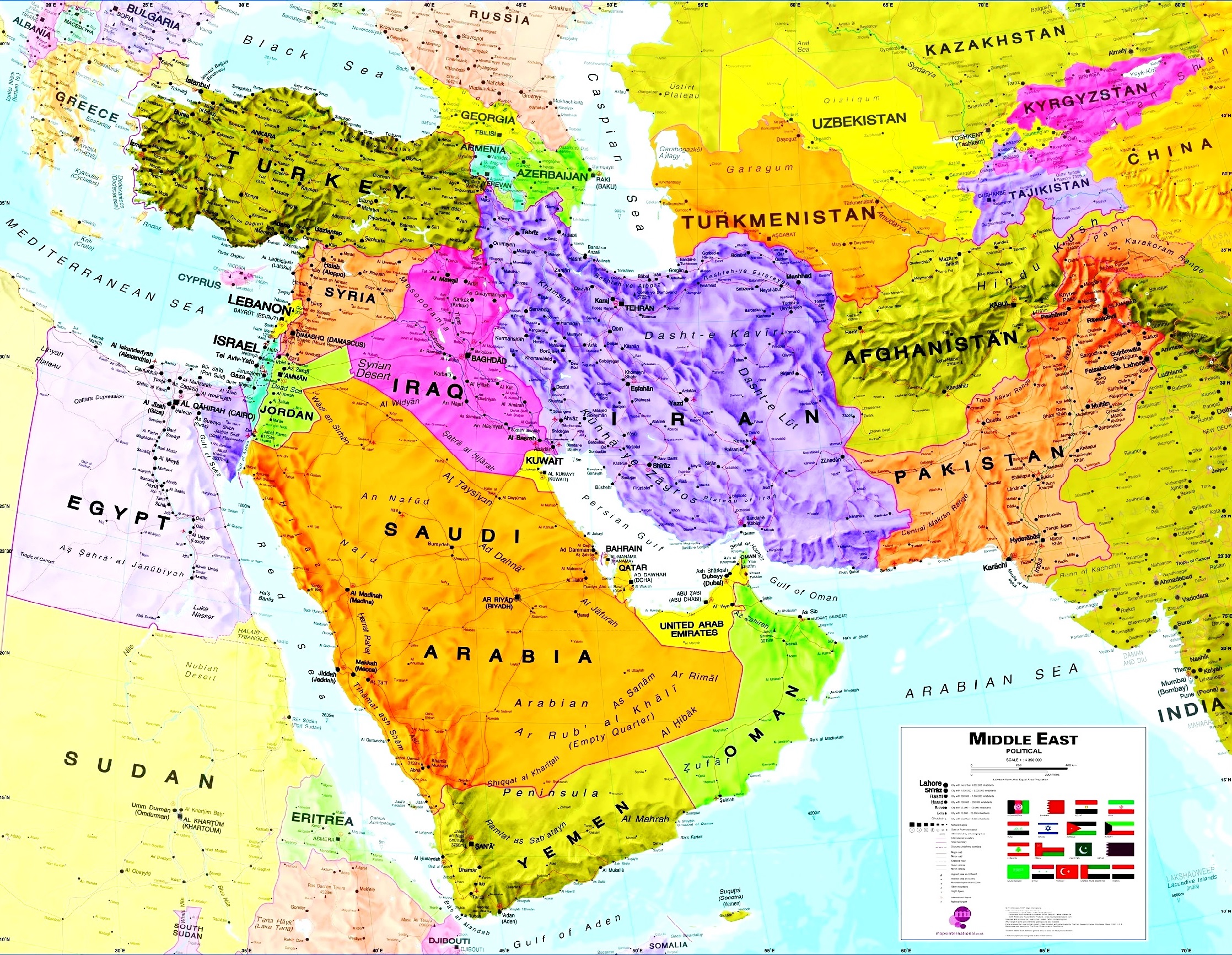
Middle East
Miscelleanous territory disputes
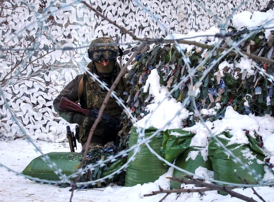
Russia/Ukraine Conflict
Antonov Aircraft Company
Bakhmut
South China Seas and Taiwan
War Zones
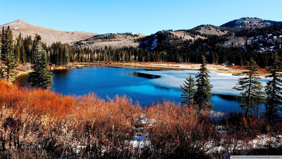
Landscapes
Population
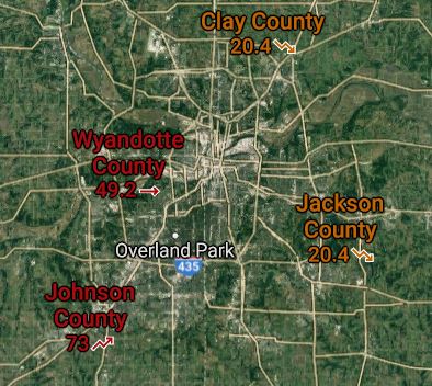
U.S. Population Migration
Societial Unrest
United States
Earthquakes
Gravity
Meteors and Asteroids
Moon
Oceans
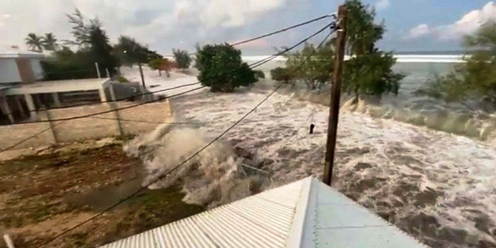
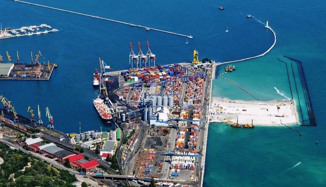
Kiribati
Tsunamis
Volcanos
Cascades
Most Dangerous
Deadly Lakes
Water
California
Orkney Islands
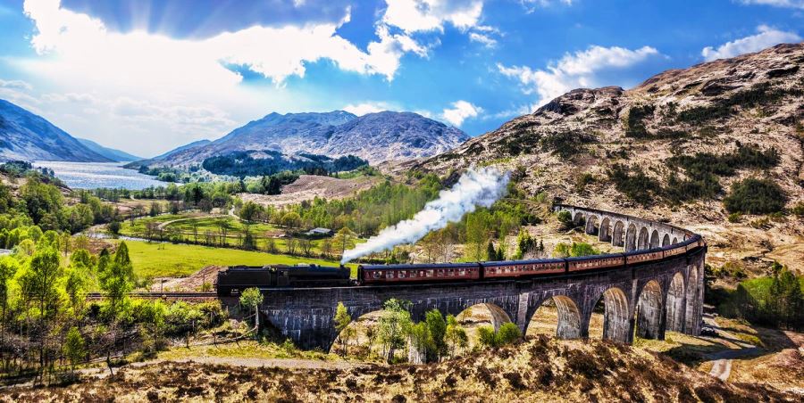
Great Glen, Scotland, United Kingdom (and Loch Ness)
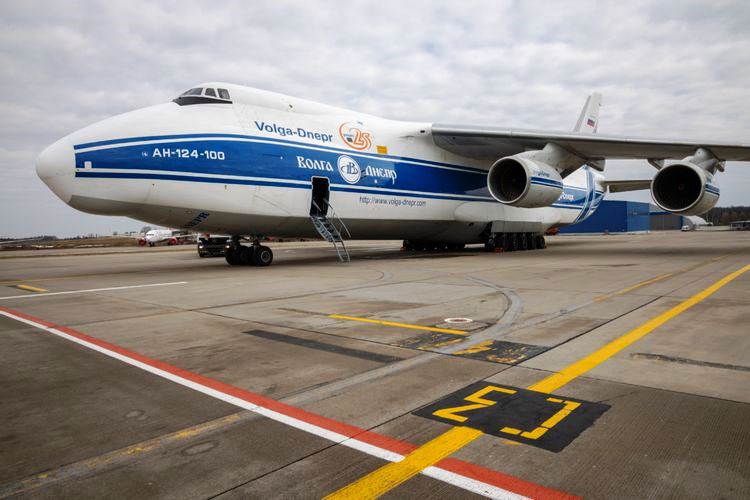
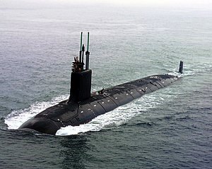
Largest aircraft in the world
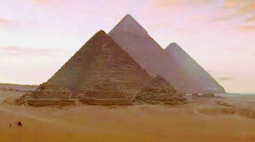
7 Wonders of the Ancient World
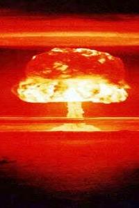
Trinity Site
News
Internet Platforms
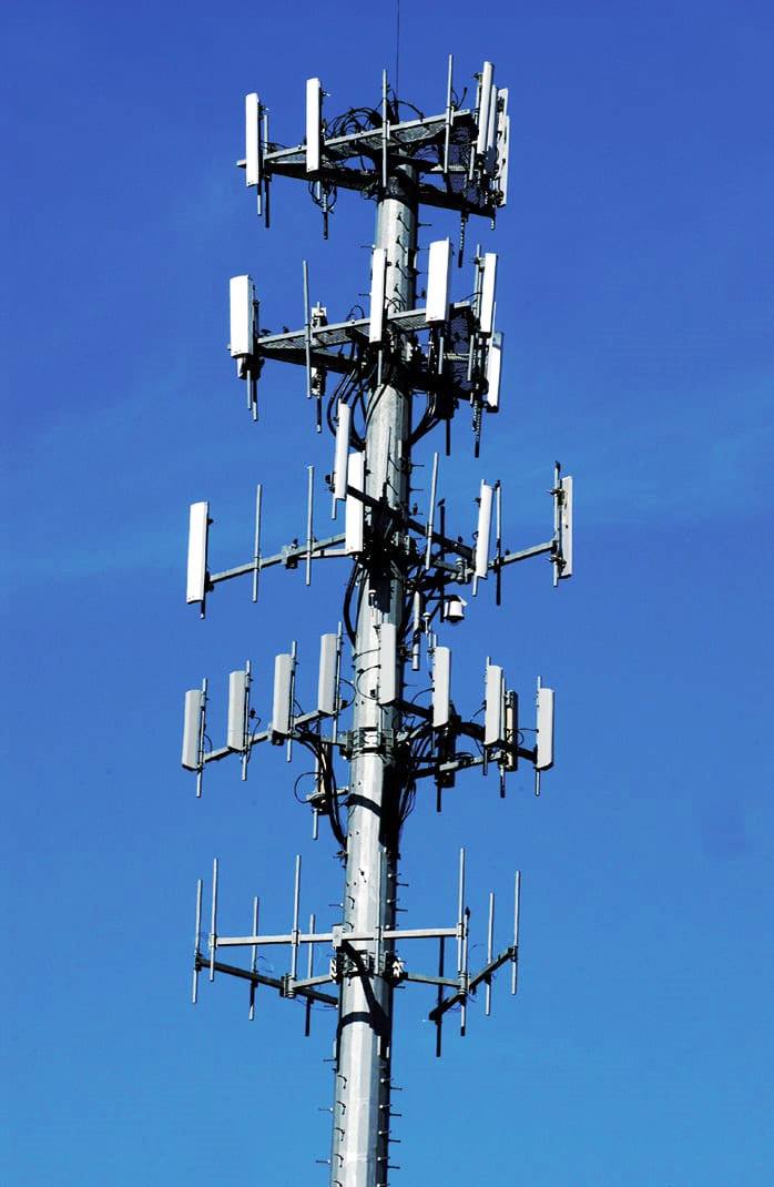
Cell Coverage
Electric Power
California Water and Power Status
Texas Power Grid
AM/FM/TV transmit towers
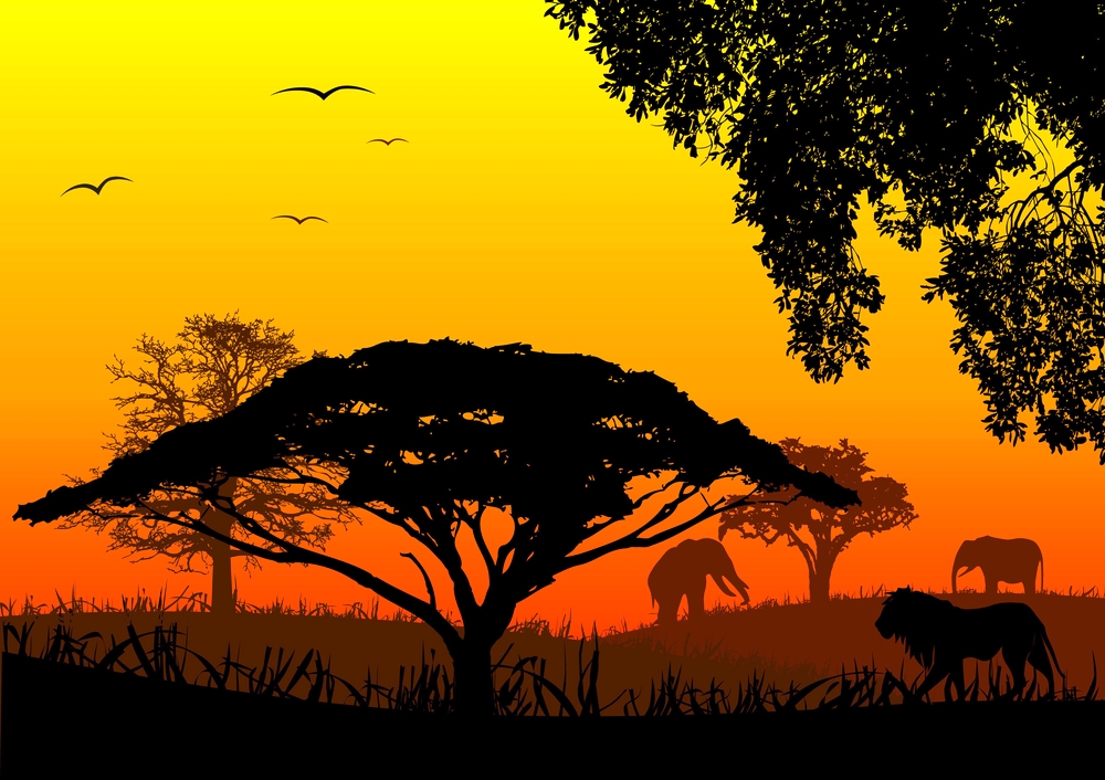
Africa
Asia & Australia
Europe
Middle East
North America
South America
The Poles
Crime
Geographic Oddities
Aokigahara Forest
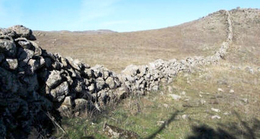
Berkeley China walls
Nature
Bull Sharks
777 Strange Bird Strike
Objects
Places
Air Travel
ETOPS
Landing at the wrong airport
The World's Most Iconic Planespotting Locations
News
Recreation
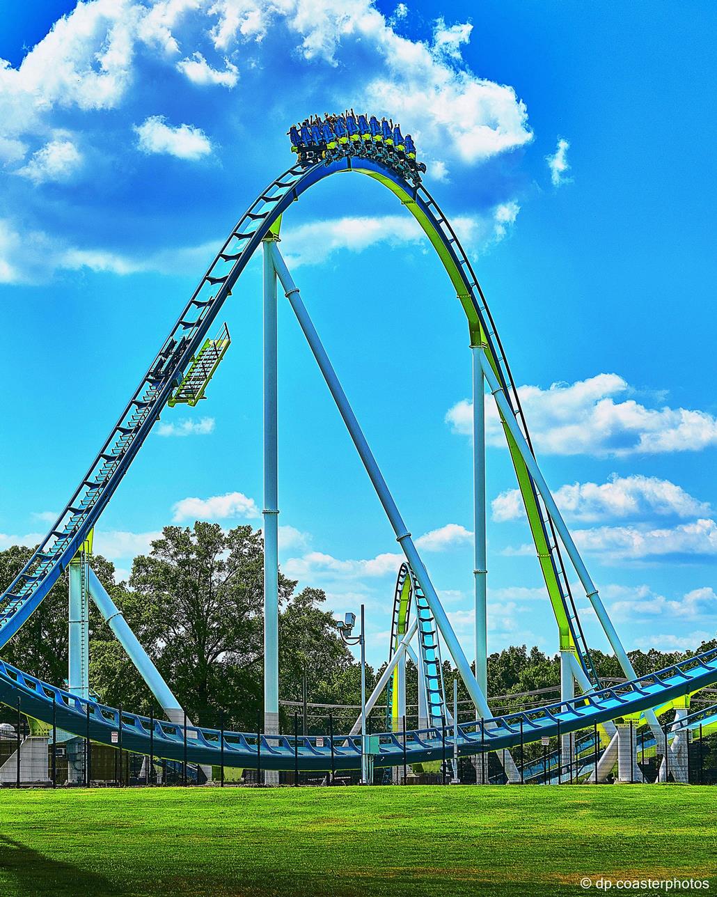
Amusement Parks
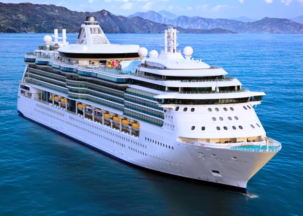
Sailing
Trains
Vehicles

Ghostbuster's
Shooting locations
Calgary
Apartment
the family was evicted from
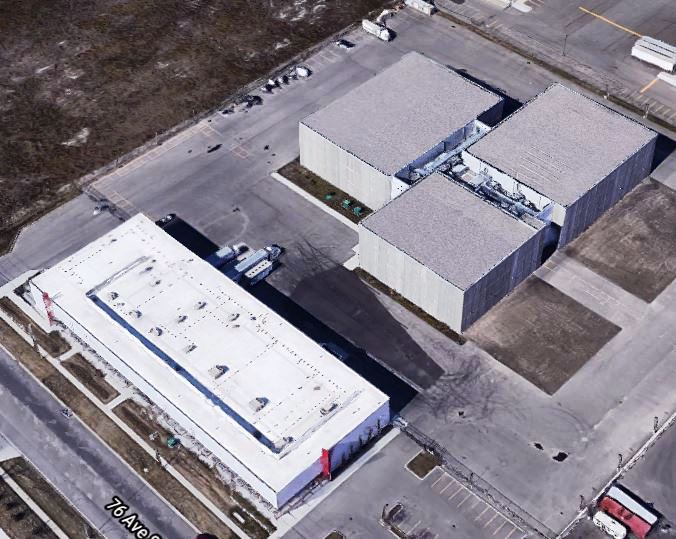 Calgary Film Centre
Many inside shots
Movie used all three sound stages (50,000 sq ft)
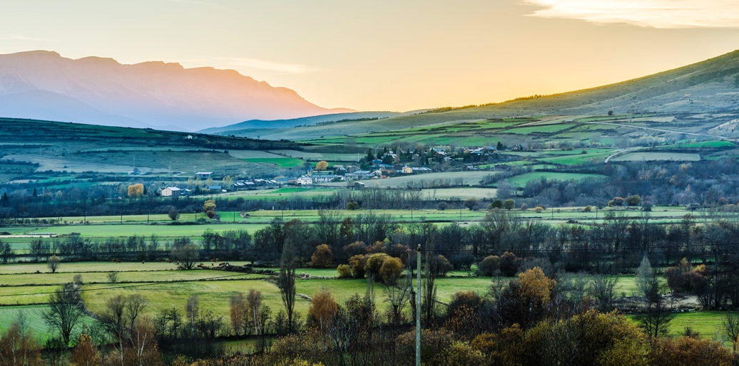
Drumheller
Driving
into Summerville
Watertower
(in the movie the name on it is Summerville)
Drive down main street
Per siesmic maps in the movie the pretend Summerville is located where Woodward, OK actually is.
Foothills County
Farmhouse location
Nearby intersection (driveway about 500 feet on the right)
Many daylight interiors shot here. All structures removed after shooting.
Beiseker
Ng's Cafe
Site of Spinners, torn down. Now the Apple Pie Café.
CrossField
Hardware Store
W.G. Murdoch School
Near Drumheller
Horsethief Canyon
Turner Valley
Turner Valley Gas Plant
Crossfield
Police Station (Google street view during filming in 2019)
Muncher chase Scene
Fort Macleod
Drumheller
(in the movie the Telus building is the Summerville Post Office)
Fort Macleod
Chase ends at Spinners
Dorothy
Yellow Bridge
Looking southwest
Calagary
Walmart
The Tomorrow War
imDB webpage
Top Gun: Maverick
Where was Top Gun: Maverick filmed? Guide to ALL the Filming Locations
Miscellaneous Movie locations: from upbeatnews.com
The Alamo in North of Brackettville, Texas

Fires
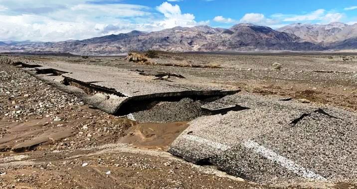
Mosquito Fire: 76,788 Acres, in El Dorado and Placer counties 9/06/22
The Planet
Earth - day/nightAntartica
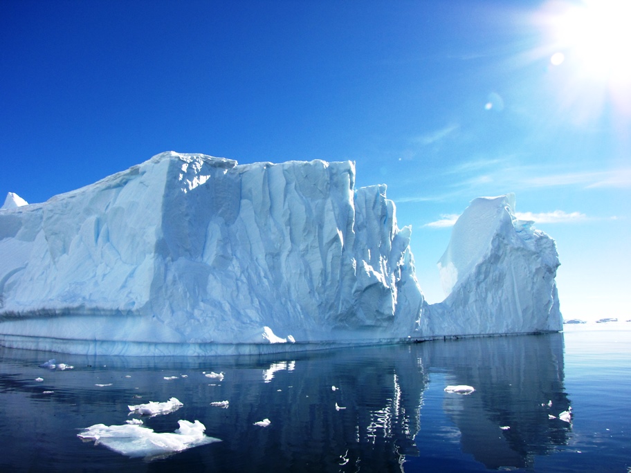
The Antarctic ice cap contains some 70 percent of Earth's fresh water and about 90 percent of its ice, even though it is only the fifth largest continent.
Zoom Earth

2022 Hurricane Season Recap: When Florida's Recent Luck Ran Out
![]()
2022 hurricane tracks
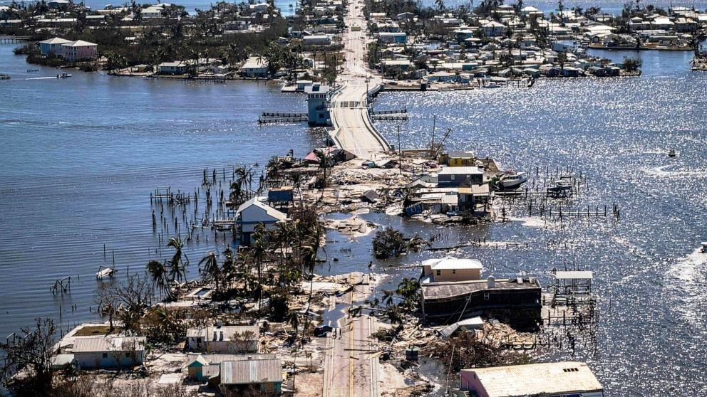
Hurricane Ian updates: Florida death toll climbs 10/01/22
![]()
National Weather Service summary
Map
Ian before and after
Lee County death toll
Lee County Map
PBS Tracking map
Lightning
Thunder and lightning reveal our planet's fiercer side. A single stroke of lightning can heat the air to around 54,000 degrees Fahrenheit (30,000 degrees Celsius), according to the book Energy by Don Herweck, causing the air to expand rapidly. That ballooning air creates a shock wave and ultimately a boom, better known as thunder.Weather Channel article from 04/09/20 12/21 NDTV article Map
Takes a bit to load - NASA Eyes on the Earth 3D interactive maps
Once you load one you can quickly change to other parameters on the site
Earth environmental satellites in orbit
Temperature
Carbon Dioxide
Carbon Monoxide
Sea Levels
Soil Moisture
Ozone
Water Vapor
Gavity Field
Defined
From World Atlas:


General
Science Daily Geography News Sci News Geography News
The Problem with 2D Maps
Why don't we start using a more accurate world map rather than the conventional Mercator map?
Borders
The most northern, western, & eastern state in the U.S. is one and the same!Why?
The islands of Big Diomede in Russia and Little Diomede in the United States are separated by 2.4 miles (3.8 kilometers) of water, with the international date line running midway between them.
Geo-Politics

China
Chinese Spy Balloon Reportedly Used U.S.Made Gear That Could Be Bought Online 06/26/23 Map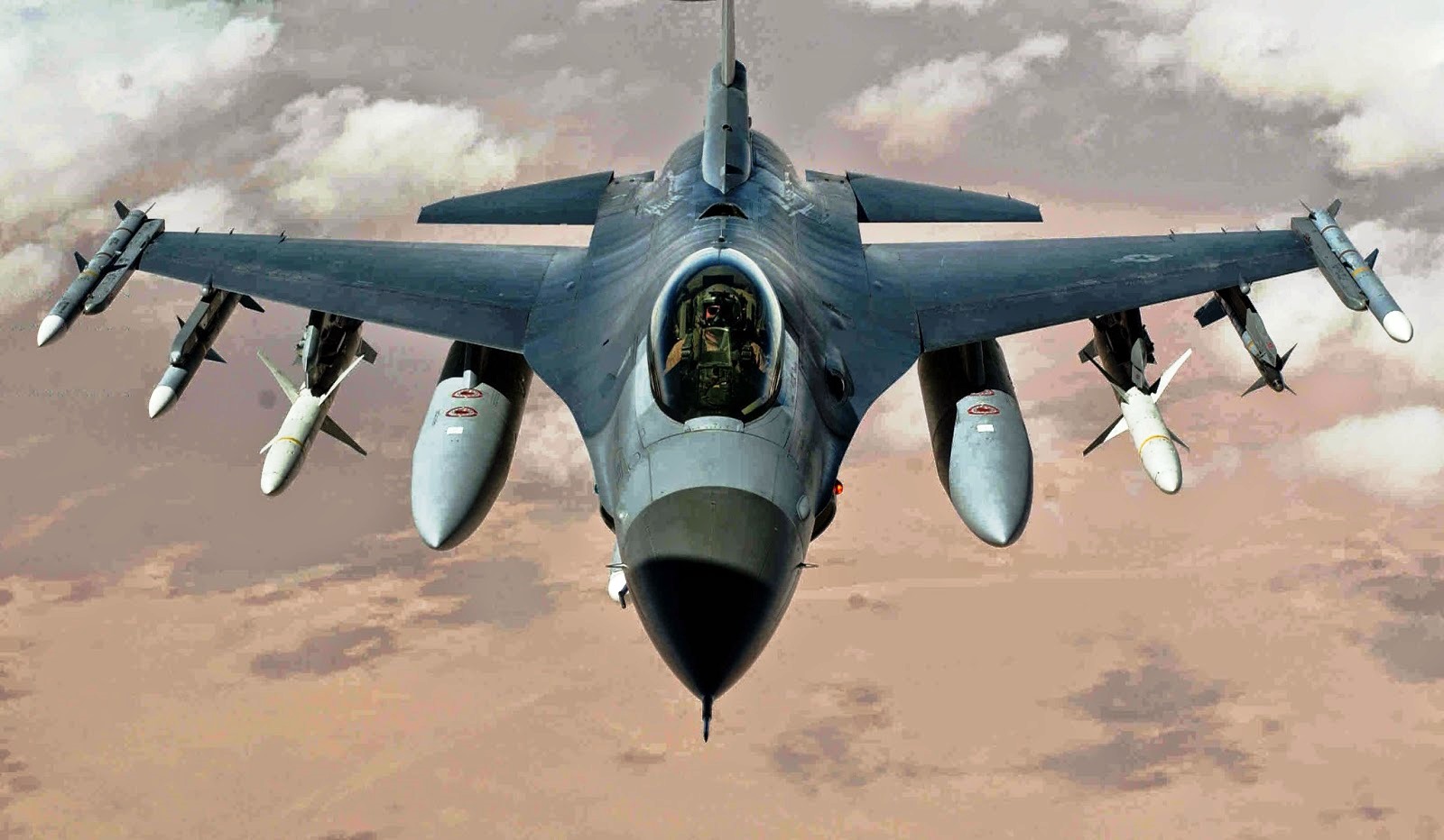 Unidentified object shot down over Lake Huron 02/12/23
Map
Unidentified object shot down over Lake Huron 02/12/23
Map
F16 shot down this object
Cold War
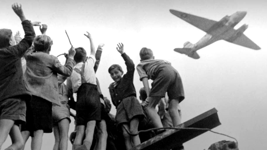
Berlin Airlift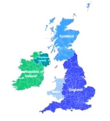
British Isles
United Kingdom
Middle East
Hamas Israel war Map
Battles in east Rafah amid dispute over reopening of Kerem Shalom crossing 05/08/24 BBC story Map
Houthi Attacks Map
Missile attack by Yemen's Houthi rebels damages a ship in the Red Sea 04/29/24 AP article Map
Iran Map
An Israeli-owned ship was targeted in suspected Iranian attack in Indian Ocean 11/25/23 AP article Map
Miscelleanous territory disputes
Canada and Denmark end decades-long dispute over barren rock in Arctic 6/14/22 Map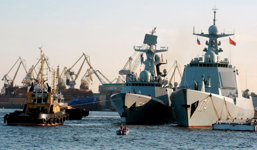
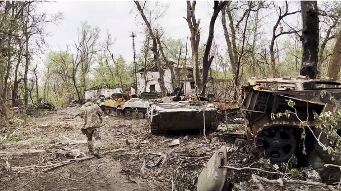
Russia/Ukraine Conflict
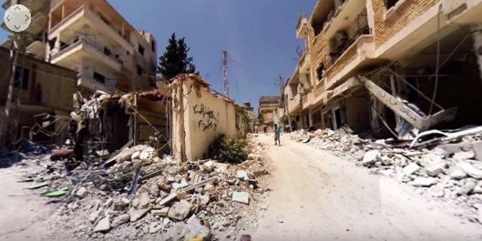
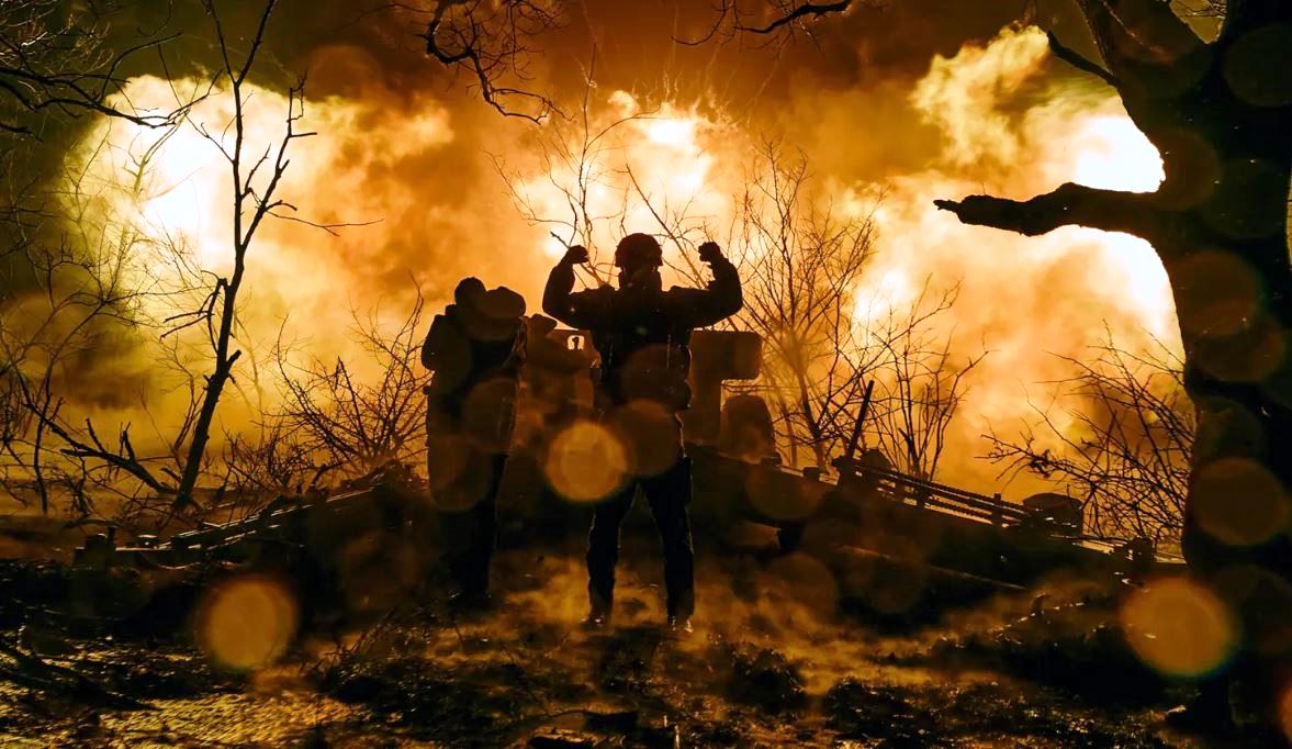 Bakhmut
Uncovering the extensive destruction of Bakhmut in a new detailed analysis 06/21/23
![]()
Ukraine locked in trench warfare as Russian push for Bakhmut continues 11/28/23
![]()
Map
 NATO launches analyses for hardening its eastern flank 3/16/22
 Ukrainian soldiers drill urban warfare scenario in deserted Chernobyl town 02/04/22
 Russian occupation authorities temporarily close Crimean Bridge 08/17/22
Map
Russian occupation authorities temporarily close Crimean Bridge 08/17/22
Map
 10% of the world’s wheat comes from Ukraine
Wheat production map
Map
10% of the world’s wheat comes from Ukraine
Wheat production map
Map
China, the South China Seas, and Taiwan

Population

Societial Unrest
South Korea searches for answers after Halloween festivities leave 151 dead 10/30/22 MapDefined
From World Atlas:
Earthquakes
U.S.G.S. Latest Earthquakes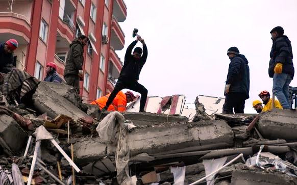 2/16/21 Japanese Earthquake
The Weather Network Article
Japan Times Article
National Geographic Article
2/16/21 Japanese Earthquake
The Weather Network Article
Japan Times Article
National Geographic Article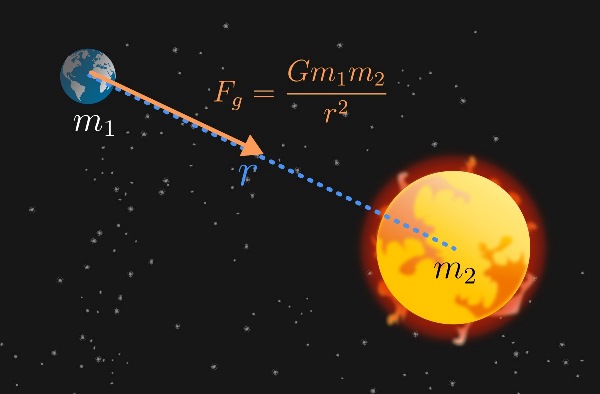
Gravity
Hudson Bay
Because our globe isn't a perfect sphere, its mass is distributed unevenly. And uneven mass means slightly uneven gravity.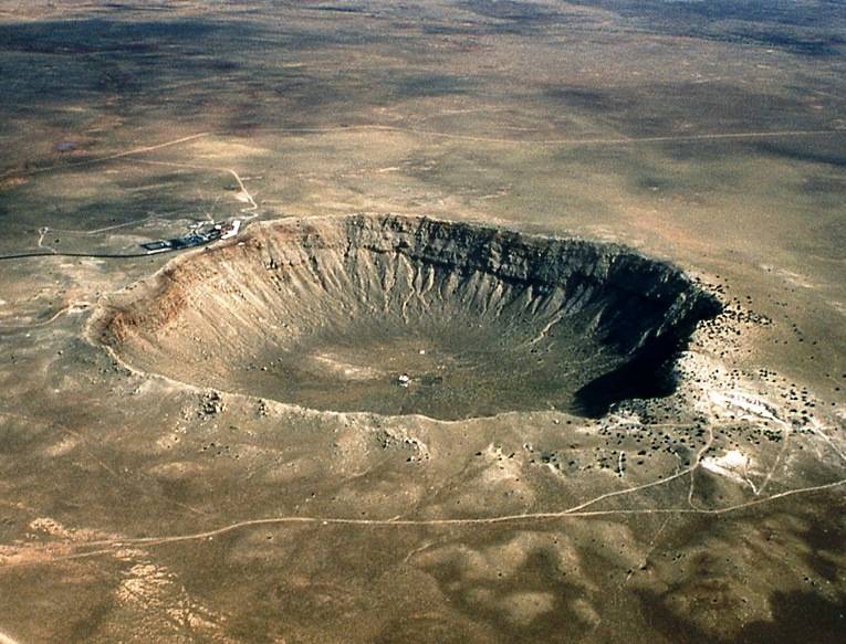
Meteors and Asteroids
NASA Eyes on Asteroids Interactive map
Oceans
Antarctica fish breeding area discoveredMauna (Mt.) Kea - Tallest in the world?
The title for tallest mountain goes to either Mount Everest or Mauna Kea. The summit of Mount Everest is higher above sea level than the summit of any other mountain, extending some 29,029 feet (8,848 meters) high, according to the Indian Journal of History of Science. However, when measured from its true base to summit, Mauna Kea takes the prize, measuring a length of about 56,000 feet (17,170 m), according to the USGS.Kiribati
The seas are coming for us in Kiribati. Will Australia rehome us?
Our existence might be in jeopardy: How Kiribati is being swallowed by rising seas
THE WORLD FACTBOOK
The Country & Geographic Location
Map
![]()
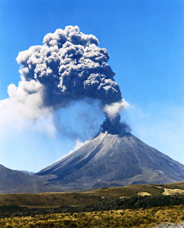
Volcanos
Active volcanoes map
Anak Krakatau
![]()
Cascades
USGS article
Wiki complete list of Cascade Volcanos
Recent eruptions
Mount St. Helens - 2008Most Dangerous
The Most Dangerous Volcanoes In The World
Krakatoa
Popocatépetl
Mount Rainier
Mount Fuji
Mount Vesuvius
Deadly Lakes
The Killer Lakes of Cameroon
Lake Monoun - Disaster
Evolution of CO2 in Lakes Monoun and Nyos, Cameroon
Map
Water
The Earth's Water Where is Earth's Water?California
California Water Levels Map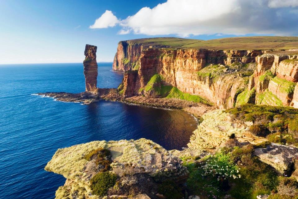
Orkney Islands
Great Glen, Scotland, United Kingdom (and Loch Ness)
The Great Glen: coast to coast along Scotland’s rift valley
Aleutian Islands campaign
Battle Map
Berlin Wall
Perserved strip of the cold war barrier
Map
Camp Century - US nuke base in the Arctic
Map
Fort Pillow Massacre
Map
Great Lakes Aircraft Carriers – The U.S. Navy’s Forgotten Fresh-Water Flattops
Conducted the most take offs and landings over the course of World War 2 ![]()
Where they docked
Hindenburg disaster
Map
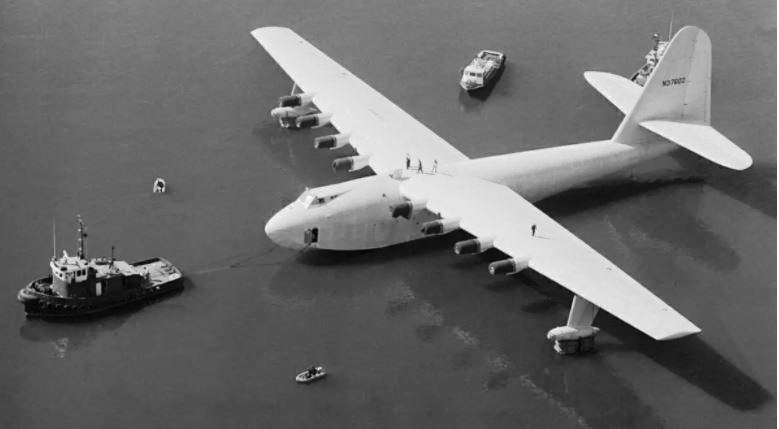
Largest aircraft in the world
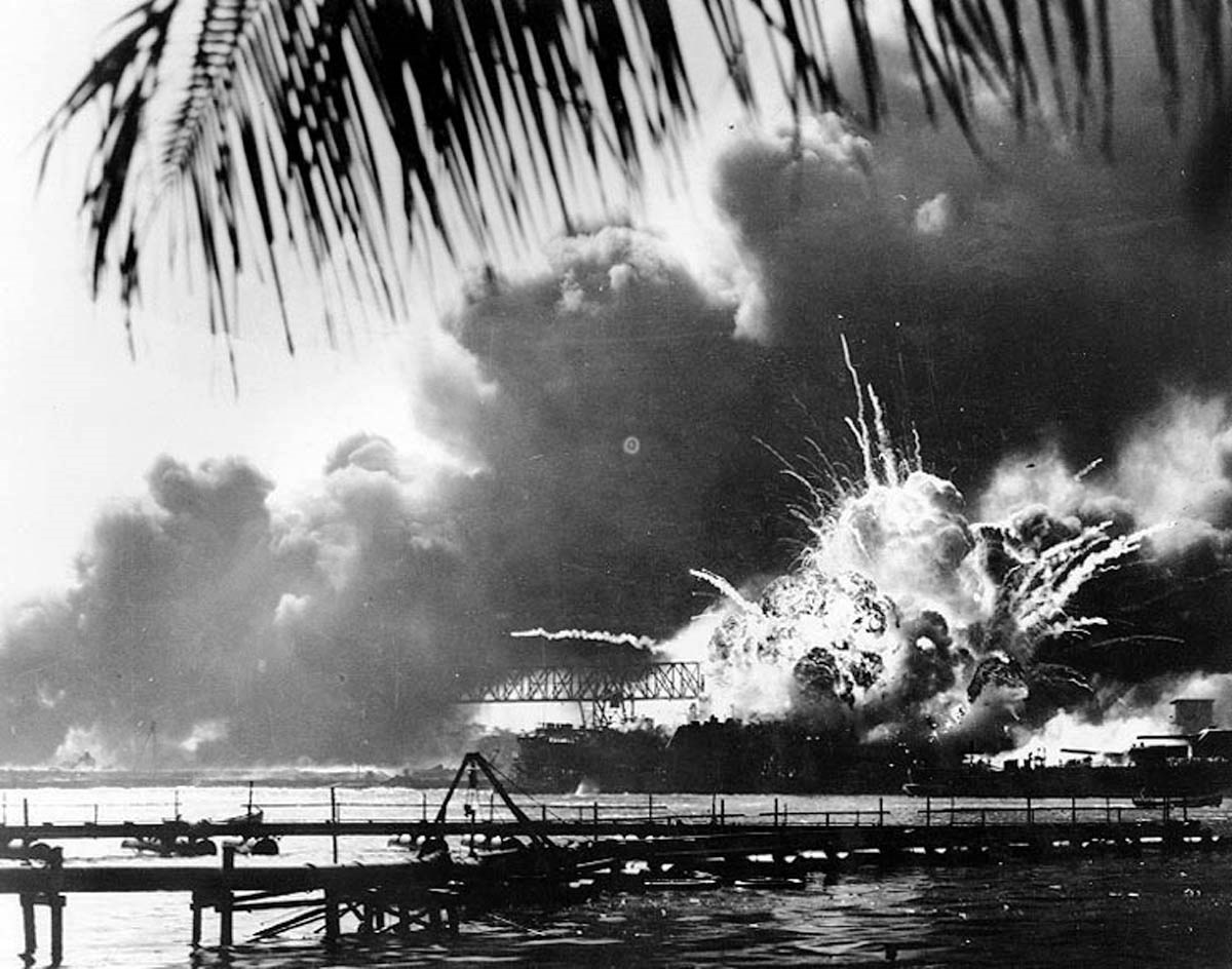
Pearl Harbor
News
Western US at risk for widespread blackouts through dog days of summer 7/26/22
Internet Platforms
Internet platforms status![]()
Electric Power
Power Outages Map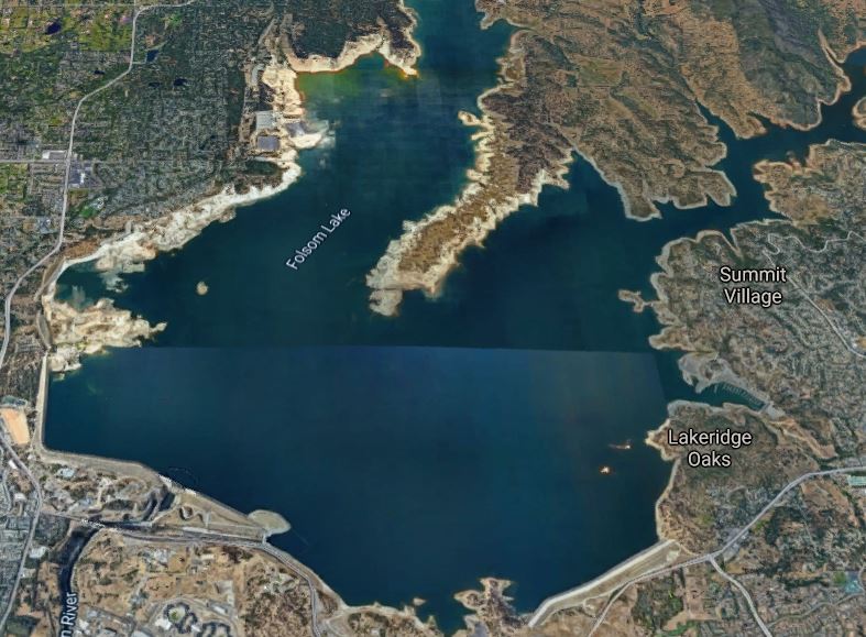
California Water and Power Status
California Water Levels Map
Africa
The two Niles Wiki Nile River maps Course and Navigability Map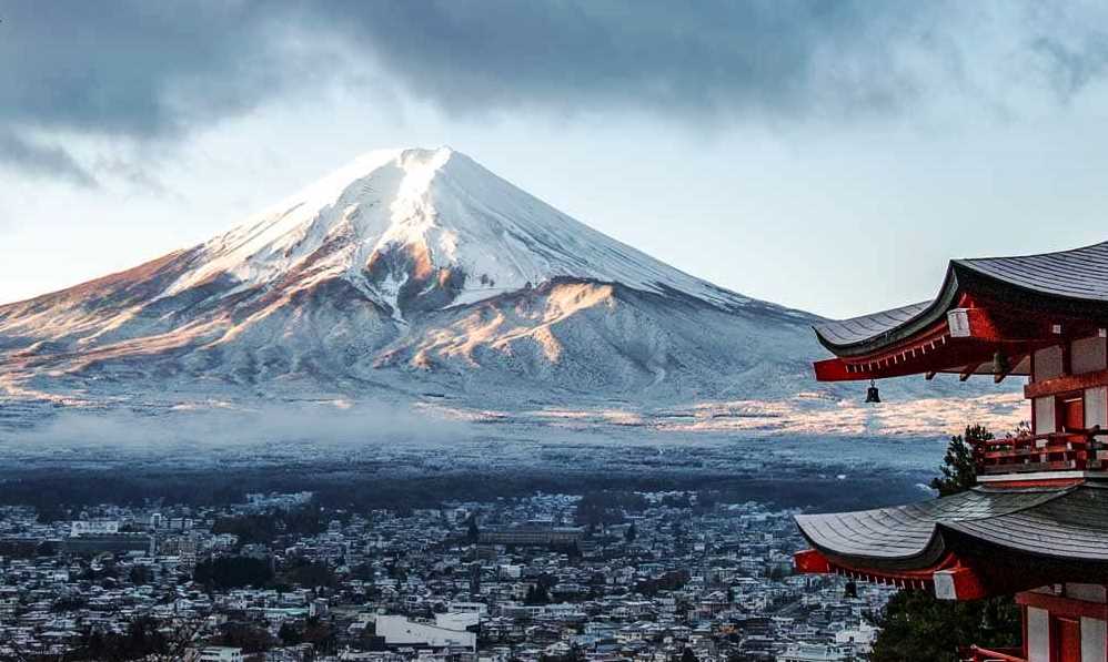
Asia & Australia
Aokigahara forest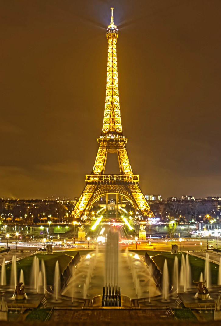
Europe
Place with the shortest name - Means river in the local language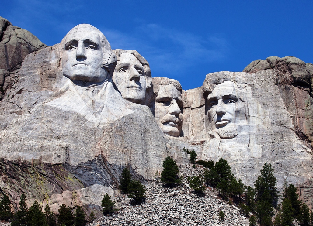
North America
Joint Base Andrews Map
California' other two Suicide bridges
The Creepy Los Angeles Suicide Bridge: Suicide Hotspot And Paranormal Encounters MapRacetrack Playa - Death Valley
Rocks can walk on Earth, at least they do at the pancake-flat lakebed called Racetrack Playa in Death Valley. There, a perfect storm can move rocks sometimes weighing tens or hundreds of pounds. Most likely, ice-encrusted rocks get inundated by meltwater from the hills above the playa, according to NASA researchers. When everything's nice and slick, a stiff breeze kicks up and moves the rock. Rivers effect on borders
Changing Mississippi
Map
Rivers effect on borders
Changing Mississippi
Map Private Sector Space Launch Centers
Map - Blue Origin West Texas Suborbital Launch Site
South America
Cascada el Pailon del Diablo Amazing Places article MapWhy/How?
Despite the fact that Mount Everest is considered
 Crime
Crime
Geographic Oddities

(AKA the Demon Forest, the Suicide Forest, and the "perfect place to die")
AOKIGAHARA, THE SUICIDE FOREST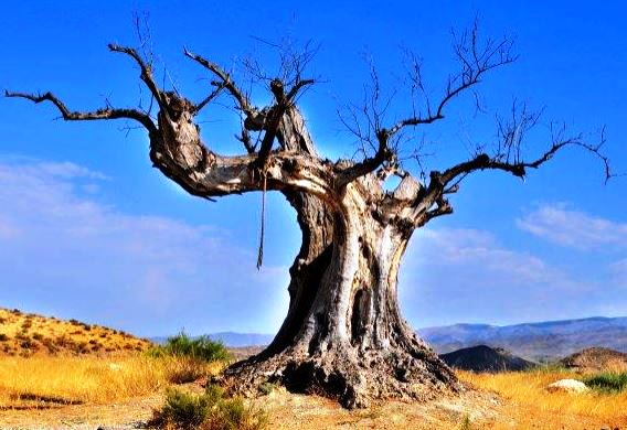
Nature
Bull Sharks
The Bull Sharks of Lake Nicaragua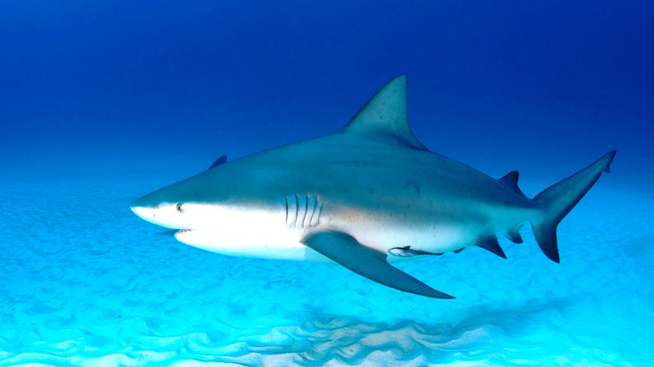 More Bull Sharks- The site of the New Jersey Shark Attacks of 1916
Map
More Bull Sharks- The site of the New Jersey Shark Attacks of 1916
Map
Could there actually be Bull Sharks in the Midwest?
Bull Shark Distribution Map
Notice the blue spike pointing up towards the Great Lakes - That is the Mississippi!
777 Strange Bird Strike
KLM Boeing 777 Operates Six Hour Flight To Nowhere After Bird Strike
Objects
Largest Coca-Cola Logo
Places
China and Xinjiang
Xinjiang
Air Travel
Flight Survival Guide
ETOPS Rules
What Are ETOPS Rules And Why Do They Matter?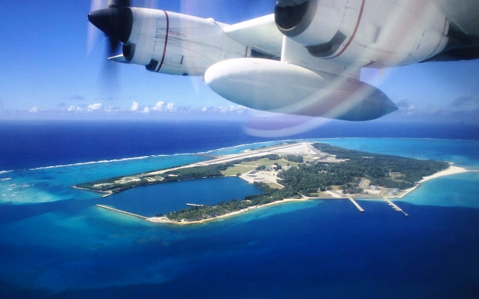
Emergency Landings
10 airports where emergency landings happen all the timeMidway's Henderson Field
MidwayLanding at the wrong airport
It Is Fairly Common for Pilots to Land at the Wrong Airport, Article from the Atlantic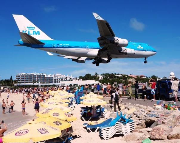
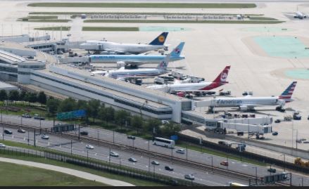
Top 5: The World's Most Iconic Planespotting Locations
Article from Simply Flying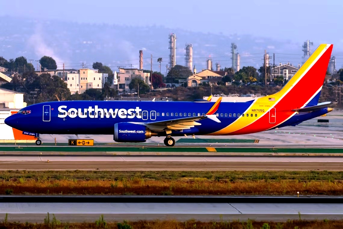 The US Airports At The Highest Altitudes 02/21/23
Map
The US Airports At The Highest Altitudes 02/21/23
Map
Southwest makes 52% of the total flights on 10 separate routes
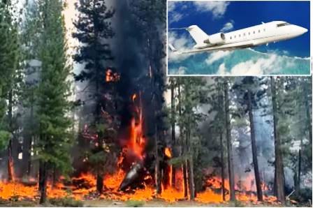
Challenger 605 Crash in Truckee, CA
Explore what might have caused this tragic crash during approach into an historically demanding airport
Article on Crash in Truckee
Update: Challenger 605 Crash in Truckee
Flight Safety Foundation Final Report
NTSB Final Report
Flight Path
Additional background
More
Aircraft info
Ring camera captures apparent sounds of jet crashing in Truckee
Crash site