ETOPS: Extended-range Twin-engine Operational Performance Standards
Maps gernerated using Great Circle Mapper (http://www.gcmap.com/)
Airliner capability has been steadily increasing since the two-engine DC-3. Long distance travel really took off after WWII with the advent of four-engine passenger planes. Even into the "Jet Age" it took four engines to travel long distances. But jet engine reliability continued to improve and soon two engine jet powered planes started to venture further out to sea. Today most long haul planes have only two engines. Here we will look at some examples of ETOP flights.
Also we will look at the difference between the traditional Rectangular maps' verses looking at a true depiction of a planes flight path using Orthographic maps.
ETOPS and the rise of long-haul twin engine flying, explained by a pilot
Traditional Rectangle map centered on San Francisco
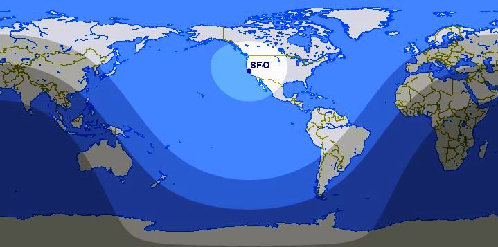
Closest highlighted area around SFO was the range that a DC-3 could eventually reach towards the end of its production (1500 miles). With the introduction of the four engine piston, and then jet aircraft, the range was increased to include the next shaded area (5400 miles). Eventually four engine jet aircraft could reach the next shaded area (6880 miles). Today the two engine Boeing 787 can extend out to the limits of the furthest shaded area (8700 miles).
The shape of the ranges is often not intuitive on this type of map. In addition this depiction make many areas, Greenland stands out, as much larger than it really is.
Orthogonal map centered on San Francisco
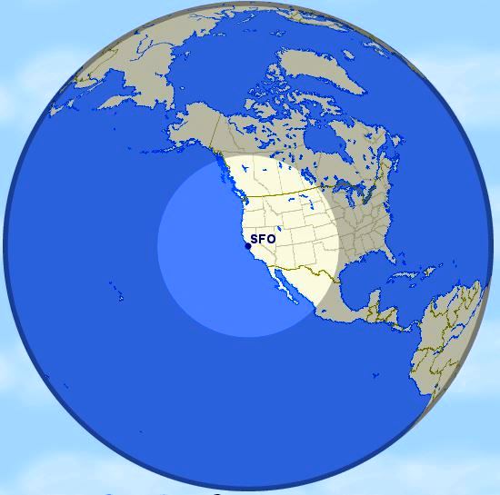
Here the DC-3 range is easy to see, but the next range (5400) reaches out almost to the horizon from our vantage from space directly above SFO.
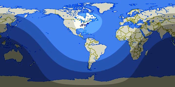
Traditional Rectangle map centered on New York's JFK airport
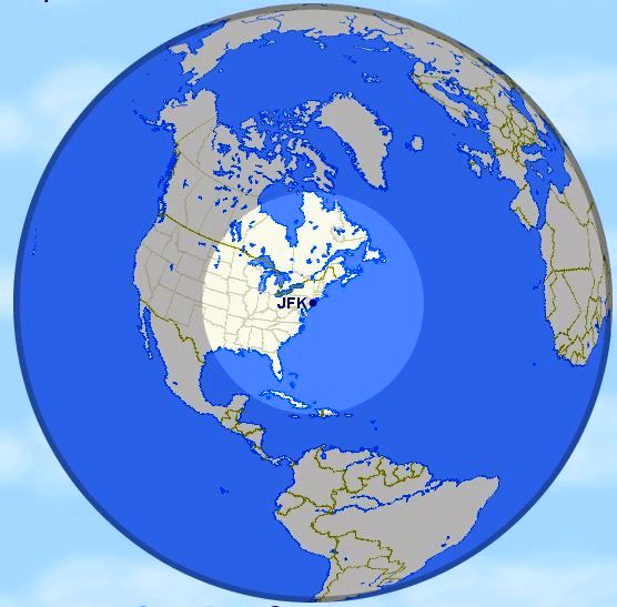
Orthogonal map centered on New York
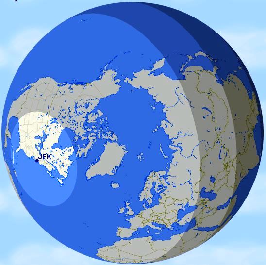
Orthogonal JFK range map centered over the North Pole
First Trans-Atlantic Flight
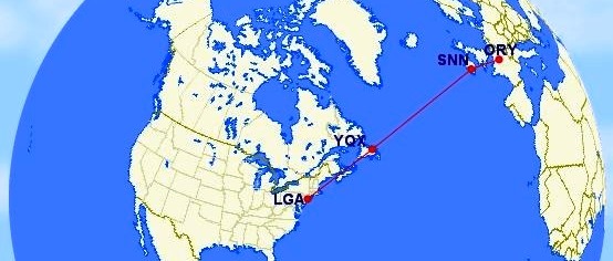
February 5th, 1946, TWA conducted its first commercial transatlantic flight
First leg - LaGuardia to Gander International Airport (1,098 miles)
Second leg (Crossing the Atlantic) - Gander to Shannon International Airport (1,981 miles)
Third leg - Shannon to Paris Oly (main Paris airport at the time) (566 miles)
On a rectangular map the path across the Atlantic would look curved.
First twin engine ETOPS flight
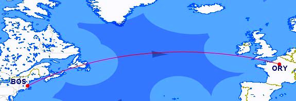
In 1985, special allowance was given to Trans World Airlines to fly their twin-engine 767 transatlantic from Boston to Paris. This was the first ETOPS certification rating given: ETOPS 120 minutes. This means that twin-engine aircraft were allowed to fly no more than 120 minutes flying time away from the nearest airport suitable for an emergency landing.
As seen on the map the lighter areas are an hour from safe harbor, and the darker blue two hours from a suitable airport. Only the small dark sliver in the middle of the Atlantic is more than 120 minutes from a safe landing, which the flight avoided.
Again in reality on a Orthogonal map the path would indeed be straight.
Sample polar routes
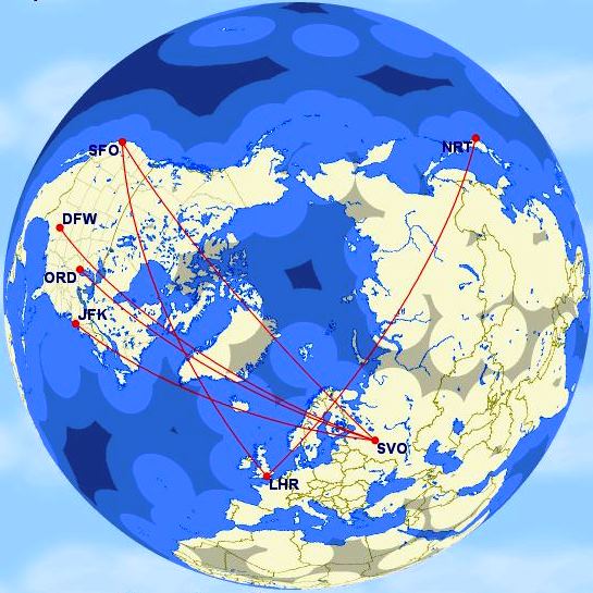
This demonstrates why flying over the North Pole is common between North America and Europe.
As can be seen even over some patches of land 60 minutes ETOPS requirements would be in effect.
Boeing 787 Range
As American targets growth, the 787-9 opens opportunities
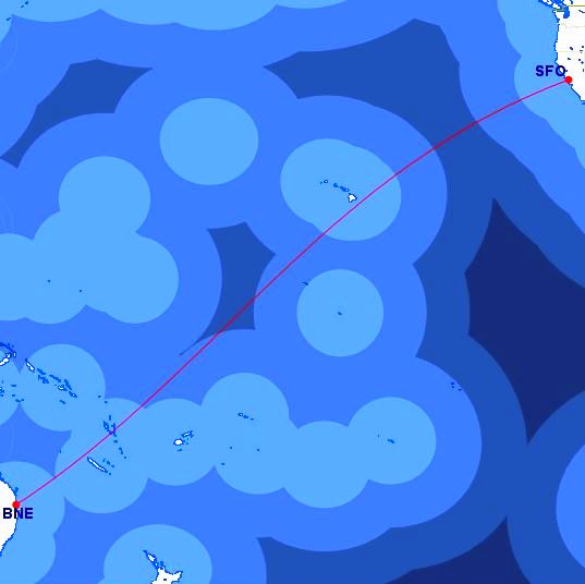
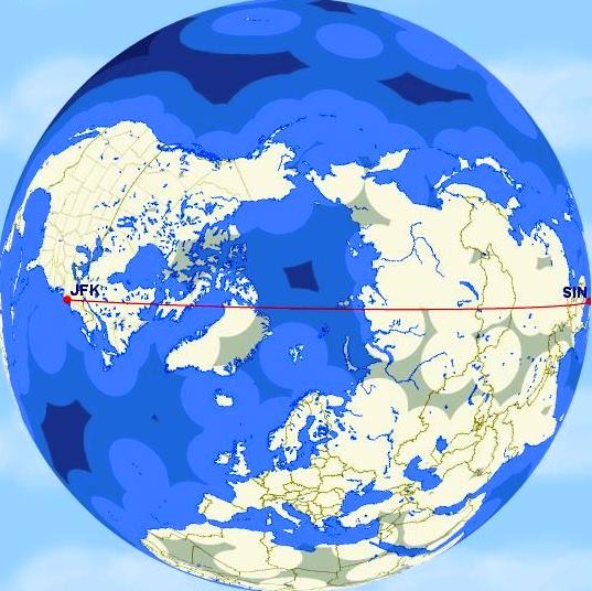
While the 8700 mile range of some 787s would give range to spare between SFO and Brisbane, a distance of 7,063 miles. The distance from JFK to Singapore is currently a bridge to far at 9,537 miles, not to mention that the flying time would be about 19 hours. At 14 hours the flight between SFO and BNE is still a long ride.
Emirates Airline
Emirates Airline is the largest airline and one of two flag carriers of the United Arab Emirates (the other being nearby Etihad). Emirates is the world's fourth largest airline by scheduled revenue passenger-kilometers flown, and the second-largest in terms of freight ton kilometers flown.
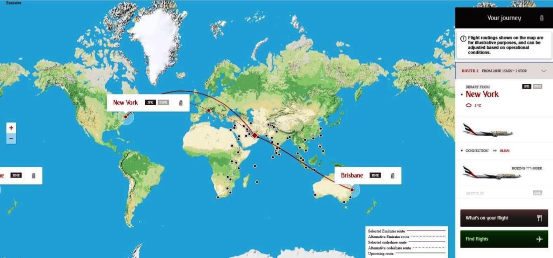
What facilitates this large operation is the central location of its main hub at Dubai. It is literally at the crossroads of Europe and Asia. The black dots on the map shows where in flys to in Europe and Asia. It also serves 12 cities in the U.S., and one each in Mexico and Canada. The map below depicts a flight from New York to Brisbane Australia, with a connection through Dubai.
Dubai Airport map
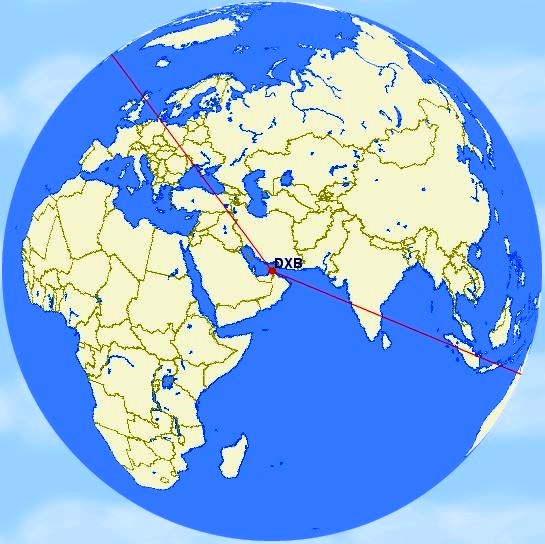
From our orthoginal position in deep space above Dubai we can again see that the flight coming in over the horizon from JFK, and the flight leaving that will drop over the horizon on its way to Brisbane, are indeed straight lines.